Hardrock West Property

Ontario, Canada

"The Mineral Exploration Research Centre (MERC) at Laurentian University is currently leading Canada's Largest Exploration Research Project, Metal Earth. This research was undertaken thanks in part to funding from the Canada First Research Excellence Fund”

Ken Berry, CEO of Galactic Gold

Hardrock West Property

Strategically Located

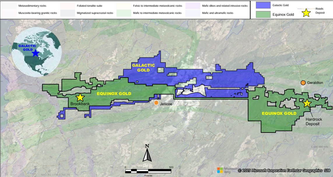
  • Galactic Gold’s “Hardrock West Property” is located two and a half hours north of Thunder Bay, ON. On Hwy 17
  • One and a half hour flight from Toronto to Thunder Bay
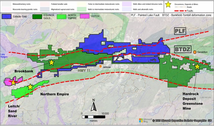
  • Our 15,000 Hectare (37K Acres) is positioned between Equinox Gold Greenstone Mine (10M oz au) and Equinox’s Brookbank Deposit (2.5M oz au)
  • A structural fault that contains in excess of 12.5M Gold Oz.

"Orogenic Gold Deposits are some of the Largest, High-grade Gold Deposits on the Planet”

Ken Berry, CEO of Galactic Gold

Hardrock West Property

Highlights

  • Over 57 km of combined strike length along two major gold bearing structures (PLF and BTDZ)
  • Directly on strike 10 km away from Equinox Gold’s Greenstone Mine (12.2 million oz au)
  • Numerous gold deposits occur along structures:
    • Brookbank Prospect (1.7 million Oz Au)
    • Leitch and Sandriver Mines (897 356 Oz Au)
    • Sturgeon River Mine (73,738 Oz Au)
    • Solomons Pillars Mine (production unknown)
Hardrock West Property

Orogenic Gold Deposits

  • Orogenic Gold Deposits

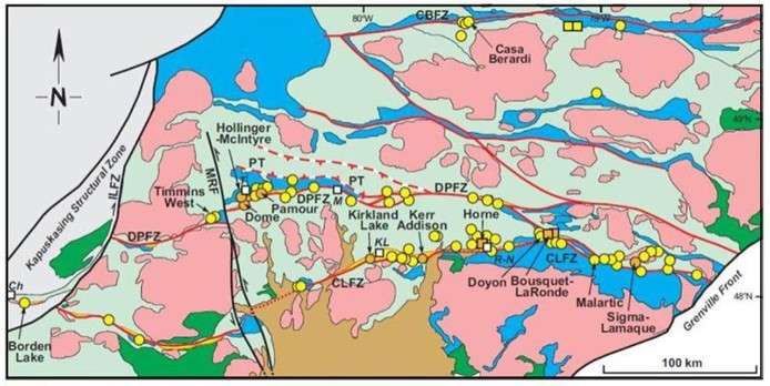
    • Orogenic Gold deposits rely on large “1st order” structures that act as conduits to channel fluids

  • Example: Abitibi Greenstone Belt

    • The majority of the gold deposits (~200 million ounces!) are located along two major transcrustal structures:

  • DPFZ: Porcupine Destor Break

  • CLFZ: Larder Lake Cadillac Break

    • Gold is found in splays, jogs, and secondary structures within ~ 2 km of the main structure

2025-2026

Exploration

Phase 1 – Q1 – Q4 2024

  • Additional land acquisition
  • Data compilation
  • Initial target area identification


Phase 2 – Q1 2025 – Q3 2025

  • Target assessment and ranking
  • Geologic mapping
  • Geochemical surveys
  • LiDAR and geophysical surveys
  • Ongoing Historic Data Compilation


Phase 3 – Q4 2025 -Q1 2026

  • Exploration permits & stakeholder engagement
  • Pipeline target generation
  • Detailed geological mapping
  • Outcrop stripping & channel sampling
  • Drill planning on pipeline targets

2021 – 2025

  • Reflective seismic (R1 and R2) to 40 Km depth into crust
  • Magnetotellurics (MT) survey and variety of EM deep study down to 50 Km in the mantle
  • Gravity Survey to 10 Km depth
  • Three-year mapping program (97 km along the transect)
  • Whole rock geochemistry and assays
  • Oxygen isotopes
  • AI study incorporating regional data (pending release)